1

Yaya Tso Lake

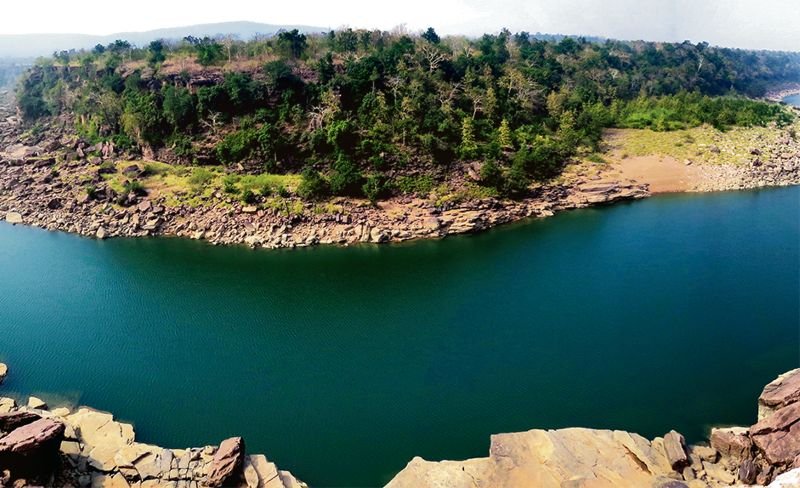
Recently, Yaya Tso Lake was declared Ladakh’s first biodiversity heritage site under the Biological Diversity Act.

Why in news?

  • The Biodiversity Management Committee, the panchayat of Chumathang village, along with the SECURE Himalaya Project recently resolved the issue and declared Yaya Tso Lake a biodiversity heritage site.

Key facts about the Yaya Tso Lake

  • Lake Yaya Tso is known as a bird’s paradise for its beautiful lake located at an altitude of 4,820 metres in Ladakh.
  • It is a nesting habitat for a large number of birds and animals, such as the bar-headed goose, black-necked crane and brahminy duck
  • It is also one of the highest breeding sites of the black-necked crane in India.

What is the Secure Himalaya project?

  • It is funded by the Global Environment Facility.
  • It supports the government’s efforts for the conservation of snow leopard and its habitat by developing and implementing a landscape-based approach for Himalayan ecosystems, and addresses key issues of habitat degradation, threatened livelihoods and illegal trade in wildlife.
  • It was launched in 2017.

Project Landscapes:

  • Changthang, Ladakh Landscape, Jammu & Kashmir
  • Lahaul-Pangi and Kinnaur Landscapes,
  • Gangotri-Govind and Darma-Byans Landscapes,
  • Khangchendzonga-upper Teesta Valley.


Asia Has Had a Really Cold Month, Courtesy of the Polar Vortex

Why in News?

  • Mohe, China’s northernmost city, recorded a temperature of minus 53oC this week. That was the coldest in its recorded history.
  • Scientists say Asia’s extreme cold is largely the result of the Polar Vortex phenomenon.

What’s in today’s article?

  • About Polar Vortex (Meaning, how it works, Relation w.r.t. Climate Change, etc.)
  • News Summary

What is a Polar Vortex?

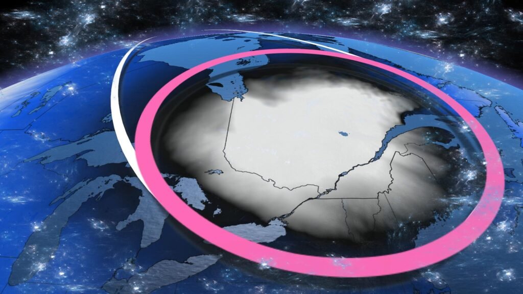
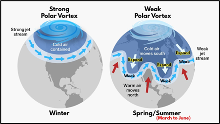
  • The polar vortex is a large area of low pressure and cold air surrounding both of the Earth’s poles.
  • It always exists near the poles, but weakens in summer and strengthens in winter.
  • The term “vortex” refers to the anti-clockwise flow of air that helps keep the colder air near the Poles.
  • Many times, during winter in the northern hemisphere, the polar vortex will expand, sending cold air southward with the jet stream.
    • Jet stream is the area of fast-moving air high in the atmosphere that surrounds the polar vortex.
  • This occurs regularly during wintertime and is often associated with large outbreaks of Arctic air in the United States & Canada.
  • Portions of Europe and Asia also experience cold surges connected to the polar vortex.

Is it a new Climatic Phenomenon?

  • Polar vortexes are not something new.
  • The term “polar vortex” has only recently been popularized, bringing attention to a weather feature that has always been present.
  • By itself, the only danger to humans is the magnitude of how cold temperatures will get when the polar vortex expands, sending Arctic air southward into areas that are not typically that cold.

Relation w.r.t. Climate Change:

  • The polar vortex is held in place by the Earth’s rotation and temperature differences between the Arctic and mid-latitudes.
  • Changes in temperature differences can make the polar vortex expand to more southern latitudes.
  • While this phenomenon occurs naturally, climate change is expected to impact the frequency and severity of polar vortex events.

News Summary:

  • China’s national weather agency issued daily warnings of extremely cold temperatures recently for almost the entire country.
  • On the Korean Peninsula, North Korea’s state meteorological agency warned residents in the last week of “the most bitter cold wave in 23 years”. And in South Korea, hundreds of flights were grounded, and beaches were covered in ice.
  • Scientists say Asia’s extreme cold is largely the result of the Polar Vortex phenomenon.
  • The term refers to an expanse of cold air that generally circles the Arctic but occasionally shifts south from the North Pole.


Mahadayi river

Government of Goa has sought an early hearing by the Supreme Court in the Mahadayi river sharing issue involving Karnataka.

Why in News?

  • The Karnataka government recently received clearance from the Central government for two Detailed Project Reports (DPR) on the Kalasa-Banduri water diversion project on the Mahadayi River.

 About Mahadayi river:

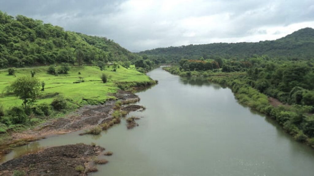
  • Origin: Mahadayi river rises in the Western Ghats, from the Bhimgad Wildlife Sanctuary in Khanapur taluk of Karnataka’s Belagavi district.
  • The river travels 35 km in Karnataka; 82 km in Goa before joining the Arabian Sea at Panji (North-Goa).
  • Also called Mandovi in Goa, Mahadayi is a rain-fed river that is shared between Karnataka and Goa for their water needs.
  • The Salim Ali Bird Sanctuary is located on the island of Chorao in the Mandovi river.
  • Major Tributaries: Kalasa Nala, Banduri Nala, Surla Nala, Haltar Nala, Poti Nala, Mahadayi Nala, Pansheer Nala, Bail Nala, Andher Nala.

 What is the Kalasa-Banduri project ?

  • The project involves the construction of dams and a canal system to divert water from the Mahadayi River, located in Goa, to the Malaprabha River (a tributary of Krishna river) basin in Karnataka.
  • The main goal of the project is to meet the drinking water needs of the districts of Belagavi, Dharwad, Bagalkot, and Gadag in Karnataka.
  • The project was proposed by the Karnataka Government in the 1980s, but faced opposition from the state of Goa.


Fukushima Wastewater Problem

Why in news?

Japan is expected to start flushing 1.25 million tonnes of wastewater from the embattled Fukushima nuclear power plant into the Pacific Ocean this year, as part of a $76-billion project to decommission the facility.

What is the issue about?

  • Reactor buildings at the Fukushima power plant (Japan) were damaged by hydrogen explosions caused by an earthquake and tsunami in 2011.
  • More than a million tonnes of water have been used to cool the melted reactors.
  • Currently, the radioactive water is treated in a complex filtration process that removes most of the radioactive elements, but some remain, including tritium – deemed harmful to humans only in very large doses.
  • The plant’s operator Tokyo Electric Power Co (TepCo) is running out of space, with these tanks expected to fill up by 2022.
  • Japan has approved a plan to release the contaminated water from the damaged Fukushima nuclear plant into the Pacific Ocean.
  • The water will be treated and diluted so radiation levels are below those set for drinking water.
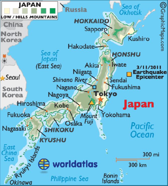
fukushima

What are the concerns with this move?

  • No threshold level – There is no known threshold below which radiation can be considered safe.
  • Health impacts – Any discharge of radioactive materials will increase the risk of cancer and other known health impacts to those who are exposed.
  • Effect on marine resource – Experts expect the affected water to poison the fish.
    • South Korea banned seafood imported from around Fukushima from 2013.
  • Presence of radionuclides – TEPCO hasn’t removed tritium from the water. Tritium is easily absorbed by the bodies of living creatures and rapidly distributed via blood.
  • In 2018, it was reported that there were other radionuclides including isotopes of ruthenium and plutonium in the treated water that could persist for longer in the marine creatures and on the seafloor.
  • Reputation – Ultimately, Japan is also concerned about its reputation.

In Japan, the nuclear accidents reduced nuclear power’s contribution to electricity generation from 30% before 2011 to 5% in 2022. But the government has articulated plans to restart older reactors and build new ones to cut the increasing fossil fuels cost.

What options do Japan have in managing the waste water?

  • Longer storage – The Japanese government can store the water for longer and then discharge it as tritium’s half-life (time it takes for its quantity to be halved through radioactive decay) is 12-13 years.
  • The quantity of any other radioactive isotopes present in the water will also decrease in this time so that the water could be less radioactive at the time of discharge.
  • Tanks in uninhabitable land – The tanks to hold the water can be situated in the land around the Fukushima facility which was declared to be uninhabitable by the Japanese government.
  • Discharge into the sea – In 2020, International Atomic Energy Agency (IAEA) officials said the discharge would be technically feasible and would allow the timeline objective to be achieved.

Quick facts

The International Atomic Energy Agency (IAEA)  

  • It is the world’s central intergovernmental forum for scientific and technical co-operation in the nuclear field.
  • The Agency was set up as the world’s “Atoms for Peace” organization within the United Nations family.
  • In 1957, the delegates to the First General Conference decided to establish the IAEA’s headquarters in Vienna, Austria.
  • It is not a specialised organisation of United Nations, however, it reports to the UN general assembly and Security Council.
  • India is a member of IAEA.


Lake Chad Basin

According to a report published by Refugees International, shrinking natural resources due to adverse weather are raising tensions across communities and displacing people of the Lake Chad region

About Lake Chad Basin

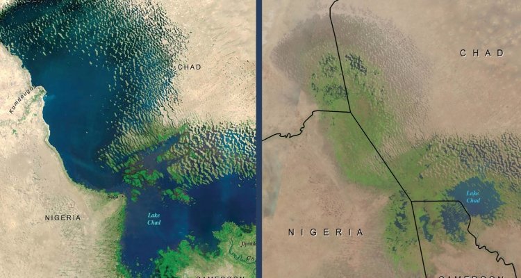
  • Lake Chad is located in the Sahel, the vast semi-arid region south of the Sahara desert.
  • It is bordered by 4 countries – Chad, Cameroon, Niger and Nigeria.
  • Source of the Lake:It is fed mainly by the Chari River through the Lagone tributary.
  • The Lagone tributary used to provide 90 % of its water.
  • Significance of the Lake: The Lake is vital for indigenous, pastoral and farming communities in these countries.
  • The lake has been supporting drinking water, irrigation, fishing, livestock and economic activity for over 30 million people in the region.
  • The Lake Chad basin in west and central Africa covers 8% of the African continent and is home to 42 million people.

What are Issues in the Lake Basin Region?

  • Lake Chad has shrunk by 90% in 60 years, and climate change is a significant contributor.
  • A 13-year insurgency of the Boko Haramextremist group and other militant groups has destabilized the Lake Chad basin and the wider Sahel region.


Indus Water Treaty

India recently issued a notice to Pakistan for modification of the Indus Waters Treaty (IWT).

About Indus Water Treaty:

  • It was signed in September 1960 between India and Pakistan.
  • The treaty was brokered by the World Bank, which too is a signatory to the treaty.
  • The treaty fixed and delimited the rights and obligations of both countries concerning the use of the waters of the Indus River system.
  • It gives control over the waters of the three “eastern rivers’ — the Beas, Ravi, and Sutlej — to India, while control over the waters of the three “western rivers’ ‘ — the Indus, Chenab, and Jhelum — to Pakistan.
  • The treaty allows India to use the western river waters for limited irrigation use and unlimited non-consumptive use for such applications as power generation, navigation, floating of property, fish culture, etc.
  • It lays down detailed regulations for India in building projects over the western rivers.


ONGC to map India’s geothermal resources

Context

The Oil and Natural Gas Corporation (ONGC) plans to map the geothermal energy sources of India in search of clean energy.

What is Geothermal Energy?

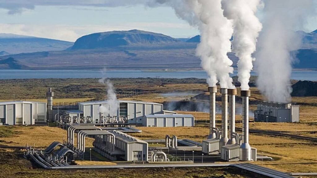
  • Geothermal energy is heat that is generated within the Earth. 
  • Geothermal energy is stored in the form of heat beneath the earth’s surface 
  • Type: Renewable resource 
  • Source: It is contained in the rocks and fluids beneath the earth’s crust and can be found as far down as the earth’s hot molten rock, magma.
  • Impact on environment: clean and carbon-free.
  • Process: A series of wells is used to generate steam from the Earth’s internal heat energy and fed to the power plant to generate electricity

Geothermal Energy in India

  • Geothermal province: There are seven geothermal provinces and a number of geothermal springs in India.
  • Total potential: According to the ministry of new and renewable energy, India has the potential to generate 10 gigawatts (GW) of geothermal power.
  • Major regions: Ladakh (Puga and Chumathang regions) has been identified as the most resource-rich region in terms of geothermal energy in the country.
    • Apart from Ladakh, there is abundant potential in Himachal Pradesh too which has several sources of geothermal energy along the rivers Alaknanda, Sutlej, Beas and Bhagirathi.
    • Efforts are also underway to utilize geothermal energy from oil and gas wells in the Gandhar oil field of ONGC’s Ankleshwar asset in Gujarat.
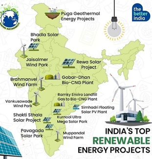
India’s Top Renewable Energy Projects

  • Puga Geothermal Energy Project, Ladakh
  • Bhadla Solar Park, Rajasthan
  • Jaisalmer Wind Park, Jaisalmer
  • Rewa Solar Project, Madhya Pradesh
  • Brahmanvel Wind Farm, Maharashtra
  • Gobar Dhan Bio CNG Plant, Indore
  • Vankusawade Wind Park, Maharashtra
  • Ramky Enviro Landfill, Gas to Bio CNG Plant, Hyderabad
  • Shakti Sthala Solar Project, Karnataka
  • Simhadri Floating Solar PV Plant, Andhra Pradesh
  • Kurnool Ultra Mega Solar Park, Andhra Pradesh
  • Pavagada Solar Park, Karnataka
  • Muppandal Wind Farm, Tamil Nadu

About Maharatna ONGC

  • The Oil and Natural Gas Corporation is a central public sector undertaking under the ownership of the Ministry of Petroleum and Natural Gas, Government of India. 
  • Headquarters: Dehradun 
  • Founded in: 1956
  • ONGC is the largest crude oil and natural gas Company in India.


Fragility of the Himalayan Mountains

Why in news?

With the sinking of Joshimath town, there is a considerable amount of research on the vulnerabilities of Himalayan geology brought to the fore.

How vulnerable is the Himalayan range?

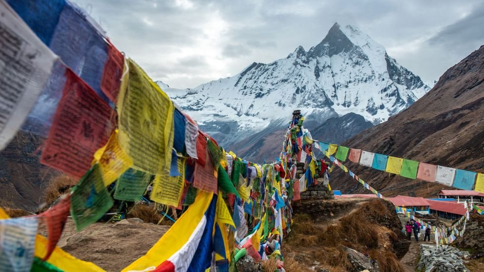
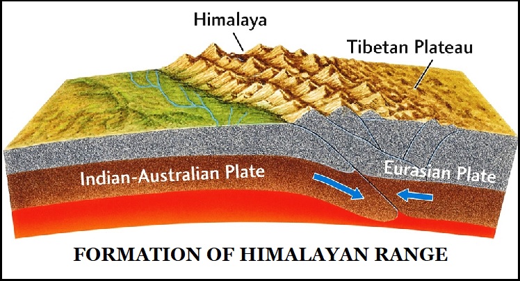
  • The Himalaya is a fragile mountain range that is still rising as the Indian plate continues to push into the Asian plate.
  • The mountains are mainly the shale upwelling of the sea, which makes them quite unstable.
  • In fact, they are largely held together by the forests that they support.

himalayanranges

What is the case of Joshimath crisis?

  • Geography – At over 6,000 feet, Joshimath sits on the side of an unstable ridge created largely from glacial moraine rock and shale in a rift valley.
  • It is also a seismic zone.
  • The ground beneath is a heterogeneous mass with pockets of variegated rock and open spaces occupied by water and mud from old glacial deposits.
  • It also holds some important aquifers.
  • Issues – Joshimath is no place for a tourist town that supports more than 2 million pilgrims a year or a four-lane highway.
  • The government has sanctioned a hydropower project in the Dhauliganga-Alaknanda basin which upon tunneling punctured an aquifer in 2009 and contributed to the Joshimath slide.
  • Uttarakhand state has more than 40,000 km of roads and counting today for tourists to visit the Char Dham sites (Yamunotri, Gangotri, Badrinath and Kedarnath).
  • India also appears to be competing with China to build high-altitude railways.
  • The mountains in Tibet on the Chinese side are made of firm rock whereas most of the Himalayan mountains are made of the unstable shale.

hindukush

What are the concerns?

  • Extreme weather events – With the consequent loss of forest cover and extreme weather events (the 2013 Kedarnath flood), catastrophes have occurred at a steady beat in all of Uttarakhand.
  • Soil and water degradation – The local soil and water have been degraded.
  • Decline in natural springs – The number of natural mineral water springs is declining.
  • Increasing landslides – The number of landslides is also shooting up.

What lies ahead?

  • If India needs any strategic border roads, they must run along rocky terrain to be stable.
  • Those roads that exist on shale or other loose-soil hills must be urgently forested to stabilise the steep hillside as well as hold water and restore springs.
  • There must be a complete ban on any hydroelectric power projects in the Himalaya, especially on the source-rivers of the Ganga (Bhagirathi and Alaknanda).
  • Indian Himalaya has to be declared as an “inviolate protected zone” and a “planet reserve” similar to the declaration of Amazon basin as a “strictly protected zone”.


Ken-Betwa river link project

Context

Recently, the Steering Committee of the Ken-Betwa Link Project (KBLP) held its third meeting in New Delhi. 

  • It was chaired by the Secretary of the Department of Water Resources, in the Ministry of Jal Shakti.

About the Ken-Betwa project:

  • Ken-Betwa interlinking is a multipurpose water development project.
  • Under this project, water from the Ken river will be transferred to the Betwa river. 
    • Both these rivers are tributaries of the river Yamuna.
  • It is one of the smallest components of the proposed National River Linking Project (NRLP) of India. 
  • The NRLP envisages transferring 178 km3 of water across 37 rivers, through a proposed network of about 30 river links.
  • It is an independent link in the peninsular component that connects two small north-flowing rivers namely, the Ken and Betwa rivers in the Greater Ganga Basin.
  • In the first phase, a 77-metre high and 2,031-metre-long dam will be constructed at Daudhan village located near the Ken and a 221-km long Ken-Betwa link canal will be built through which water from the Ken will flow into the Betwa basin.
  • The project has been delayed for a long time because of disputes between the governments of Madhya Pradesh and Uttar Pradesh over water sharing.

About National River Linking Project (NRLP)

  • This project envisages the transfer of water from the water-excess basin to the water-deficient basin by interlinking 37 rivers of India with a network of almost 3000 storage dams. This will form a gigantic South Asian water grid.
  • There are two components to this project:
    • Himalayan Component
    • Peninsular Component

Need for NRLP:

  • Many parts of the country face water shortages and droughts while other parts face flooding year after year.
  • The Indo Gangetic Rivers are perennial while the peninsular rivers are seasonal. The excess water from the plains can be diverted to the peninsula to solve the water issues.

Benefits of the National River linking project (NRLP):

  • Water crisis: The project envisages resolving the water shortage issues by diverting excess water from plains to deficit regions.
  • Hydropower generation: The building of dams and reservoirs can generate about 34000 MW of electricity from this project.
  • Weather flow augmentation: In dry weather, surplus water stored in reservoirs can be released to rivers to maintain minimum water flow in rivers.
  • Agriculture: The Farming sector in India is very much monsoon-dependent, hence the project aims to solve the lack of irrigation facilities in water-deficit regions.
  • Inland waterways: The transport and connectivity through inland waterways will benefit commercially.


Molecular clouds

An international team of astronomers have recently announced the discovery of different ices in the darkest and coldest regions of a molecular cloud measured to date

Why in News?

  • The Researchers have used the James Webb Space Telescope to prove that even complex prebiotic molecules, which are precursors to the building blocks of life, can be formed in the depths of cold, dark molecular clouds.

About Molecular clouds

  • What is it? It is an interstellar cloud of gas and dust in which molecules can form, the most common of which is hydrogen (H2). These clouds have very low temperatures of just 10 to 30 kelvin.
  • The size of these clouds can be from a few light years up to 600 light years. Their total mass can reach several million solar masses.
  • Molecular clouds with dimensions of more than about 15 light years are also called giant molecular clouds.
  • The central regions of these clouds are completely hidden from view by dust. We are able to look into the core of these clouds using radio or infrared wavelengths.
  • They are the raw material of stars and planets. These clouds do not last for a very long time.
  • After the new stars are born, their solar winds blow away the remaining gas and dust. Only a fraction, about 10%, of the original material of the molecular cloud gets locked up in stars and planets.

 What is a dark nebula (or dark cloud)?

  • It is a very dense part of a bigger molecular cloud.
  • The light extinction is caused by the high density and the presence of interstellar dust in these clouds.
  • These are the regions where new stars are forming. They mainly consist of hydrogen and dust particles which are needed to form new star systems with stars and planets.

What is a Solar Mass?

  • A solar mass is the mass of the sun.
  • It is 989 x 10^30 kilograms — about 333,000 Earths.


Inner Core of the Earth

A recent study says that the inner core of Earth seems to have stopped spinning in the same direction as the rest of the planet.

About the Inner core of the Earth:

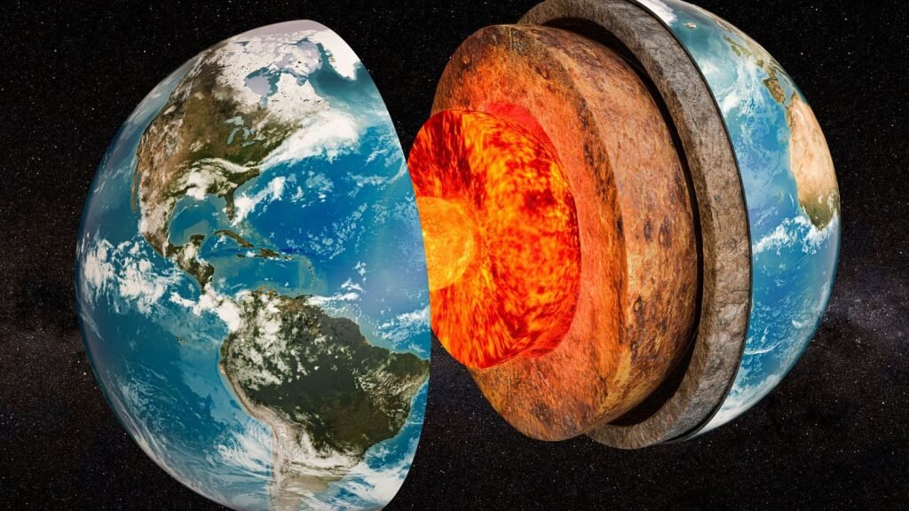
  • It is the innermost layer of the Earth.

Structure:

    • It is a solid metallic ball made mainly of iron.
    • The inner core is solid due to the pressure caused by the weight put on it by the Earth’s other top layers.
    • It is distinct from the outer core, which is a liquid.

Radius:

    • The inner core has an average radius of 1220 km.
    • The boundary between the inner and outer cores is located at approximately 5150 km below the surface of the Earth.
    • This boundary is called the Lehman Seismic Discontinuity.
  • Temperature: Inner core temperatures reach extraordinary levels, estimated to be between 7,200–8,500ºF (4,000–4,700ºC).

Properties:

    • It is predicted to have very high thermal and electrical conductivity.
    • The inner core generates its own magnetic field and spins a bit faster than the rest of the planet.

 What are the three layers of Earth?

  • The earth is made up of three different layers: the crust, the mantle and the core.
    • The crust: This is the outside layer of the earth and is made of solid rock, mostly basalt and granite.
    • The mantle: It lies below the crust and is up to 2900 km thick. It consists of hot, dense, iron and magnesium-rich solid rock.
    • The core: It is the center of the earth and is made up of two parts: the liquid outer core and solid inner core. The outer core is made of nickel, iron and molten rock.


Green comet

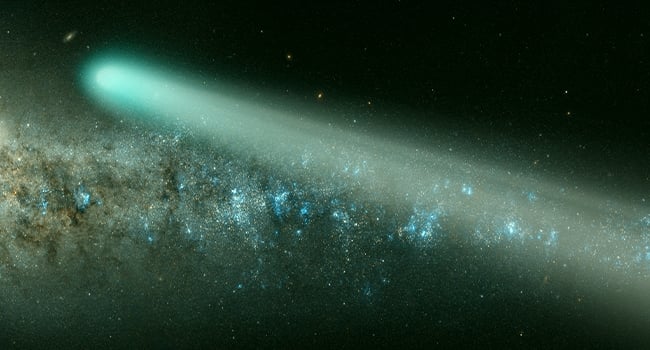
Astronomers recently spotted a comet using the wide-field survey camera at the Zwicky Transient Facility (ZTF) in the US, which is appearing near earth after nearly 50,000 years.

What are Green comets ?

  • Comets are frozen rocky or gas-filled objects that are remnants of the formation of the solar system.
  • The solid portions of a comet which is mostly water ice with embedded dust particles.
  • When near the sun, the icy cometary surfaces vaporise and emit large amounts of gas and dust, resulting in a massive atmosphere and tails.
  • The fluorescence of these gases, and especially the reflection of sunlight from the minute dust particles in the comet’s atmosphere and tail, is what gives these objects their visual impact.
  • Just like other bodies in space, comets also have orbits. They are sometimes pulled in close to the sun because of the sun’s gravity acting on them.
  • The orbit indicates this comet comes from the edge of our solar system, a distant reservoir of comets we call the Oort cloud.
  • The Oort cloud is thought to be a big, spherical region of outer space enveloping our sun, consisting of innumerable small objects, such as comets and asteroids.

What is the reason for the Green colour ?

  • Laboratory research has linked this green-like aura to a reactive molecule called dicarbon, which emits green light as sunlight decays it.


Ocean Heat Content

For the fourth year in a row, the world’s oceans recorded extreme heating in 2022 on account of anthropological activities.

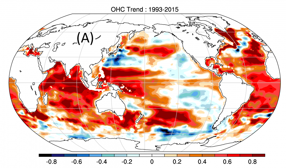
  • Ocean Heat Content (OHC) is the amount of energy absorbed by and stored in the oceans.
  • OHC is measured in joules, the unit of energy.
  • When sunlight reaches the earth, oceans absorb this energy and store it as heat.
  • While the heat is first absorbed at the surface of the water body, some of it is eventually disbursed throughout.
  • Water also has a higher heat capacity than air, which means that water heats up slower than air and can store much larger amounts of heat.

More than 90% of the excess heat accumulated in the earth’s climate is deposited in the oceans.

  • Climate change and OHC – OHC is an important indicator of climate change.
  • An increase in greenhouse gas emissions traps more energy from the sun in the atmosphere.
  • Rising ocean temperatures strengthen the exchange of energy from oceans to the atmosphere by increasing the evaporation of water and thus the quantity of atmospheric moisture.
  • This leads to changes in global precipitation patterns as well as temperatures.
  • Stratification and salinity-contrast index, along with OHC, are important elements in quantifying climate change.
  • Stratification – Vertical stratification happens when there is change in the density of water due to temperature and salinity changes in oceans.
  • This stratification hinders water mixing and consequently the exchange of heat, carbon, oxygen and so on between layers.
  • Salinity-contrast Index – Defined as the difference between the salinity averaged over climatologically high-salinity and low-salinity regions.
  • Salinity-contrast index, an indicator of a change in the water cycle, reached its highest level on record in 2022.
  • Salinity determines water density, which drives the circulation of water in oceans.


Ken-Betwa Link Project

About Ken-Betwa Link Project:

  • Under this, the transfer of excess water from the River Ken to the Betwa basin through the use of a concrete canal is proposed.
  • It is the first project under the National Perspective Plan for the interlinking of rivers.
  • It aims to provide irrigation to the Bundelkhand region, which is one of the worst drought-affected areas in India.
  • A Tripartite Memorandum of Understanding was signed between the Centre and the governments of UP and MP for the project.
  • Implementing Agency: A Special Purpose Vehicle (SPV) called Ken-Betwa Link Project Authority (KBLPA) will be set up to implement the project.
  • The National Interlinking of Rivers Authority (NIRA) has the power to set up SPV for individual link projects.